
The white villages of the Sierra de Grazalema are scattered through one of the most spectacular mountain landscapes in Andalucía. Their whitewashed houses, narrow streets and historic buildings sit among the limestone peaks and valleys of the Sierra, with each village having its own character, history and traditions. Three scenic driving routes provide different ways to explore the white villages, linking them with mountain passes, viewpoints, historic sites and some of the most beautiful countryside in Cádiz and Málaga provinces. Whether you have a day, a weekend or longer, the routes offer an excellent introduction to this remarkable corner of Andalucía.
Tours and experiences in the Sierra de Grazalema
The Sierra de Grazalema offers a wide range of places to visit and experiences to enjoy, from exploring its white villages and historic sites to guided walks, outdoor adventures and activities in the surrounding mountains. Below are some of the tours and experiences available in and around the Sierra de Grazalema through GetYourGuide, which may be useful when planning your visit.
Disclosure: The Grazalema Guide may receive a small commission if you book through one of these links. This comes at no extra cost to you and helps us keep the guide up to date.
The mountains of Western Andalucia
The Sierra de Grazalema lies across the north-east of Cádiz province and extends into the western part of Málaga province, creating a dramatic landscape of limestone mountains, deep valleys, wooded slopes and high mountain passes. The white villages are scattered throughout this landscape rather than concentrated in one area, which makes exploring them by car particularly rewarding.

The history of the Sierra is equally varied. The mountains contain evidence of human settlement going back thousands of years, including prehistoric caves and archaeological sites, while many of today’s villages developed during the centuries of Muslim rule in Al-Andalus. Their elevated positions, narrow valleys and mountain passes also made this a strategically important frontier between Muslim and Christian territories.
The result is a landscape where nature, history and traditional village life are closely connected. A drive through the Sierra can take you from a high mountain viewpoint to a quiet whitewashed village, past ancient roads and historic buildings, and through countryside that remains remarkably rural. The three routes below offer different ways to experience this landscape.
Local produce and the cuisine of the white villages

The cuisine of the Sierra de Grazalema reflects the mountain environment and agricultural traditions of the region. Local dishes make use of olive oil, cured meats, cheeses, game, trout and seasonal produce, with hearty soups and stews particularly suited to the cooler mountain climate.
Look out for Iberian cured ham and sausages, local cheeses made from sheep’s, goat’s and cow’s milk, trout, wild boar, rabbit and venison.
Seasonal ingredients such as wild asparagus and Spanish oyster thistle also feature in traditional cooking, while quince jelly, pastries, local wines and liqueurs provide some of the sweeter and more distinctive flavours of the area.
One of the best-known local products is Payoyo cheese, produced in some of the villages in the area. The surrounding mountains have a long tradition of goat and sheep farming, and the cheese has become one of the region’s best-known culinary products.
Traditional crafts of the white villages
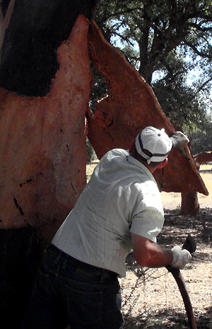
The villages of the Sierra de Grazalema have a long tradition of local crafts and small-scale production, with skills passed down through generations. Depending on the village, visitors may come across woollen textiles, ceramics, leather goods, woven esparto grass, carved wood, cork and traditional basketry.
Leatherworking is particularly associated with Ubrique, which has a long-established reputation for high-quality leather goods. Elsewhere in the Sierra, traditional materials such as wool, wood, esparto grass and local stone reflect the practical skills that developed in these mountain communities.
For visitors, these crafts offer another way of discovering the character of the pueblos blancos beyond their architecture and scenery. Local products can also make useful souvenirs that have a genuine connection with the Sierra rather than being mass-produced tourist goods.
Read about cork and its huge importance to the environment over at the Wildside Holidays website.
The three white village routes of the Sierra de Grazalema
Route 1: Grazalema-Benamahoma-El Bosque-Zahara-Grazalema
This circular route starts and finishes in Grazalema, taking in Benamahoma, El Bosque and Zahara de la Sierra. It combines several of the Sierra’s white villages with some spectacular mountain scenery and makes an excellent introduction to the area.
From Grazalema, the route crosses Puerto del Boyar, with its impressive views across the surrounding mountains, before descending towards Benamahoma and El Bosque. From here the road continues towards Zahara de la Sierra, one of the most dramatically positioned villages in the Sierra, before climbing back into the mountains towards Puerto de las Palomas and the return to Grazalema.
There is plenty to see along the way, so this is a route to enjoy slowly rather than simply drive from one village to the next. Allow time for viewpoints, photographs, walks and exploring the villages themselves.
Route 2: Grazalema-Acinipo-Setenil-Ronda-Grazalema
This route takes you from Grazalema towards Acinipo, Setenil de las Bodegas and Ronda before returning to Grazalema. It combines mountain scenery with some of the area’s most interesting historical and architectural sights, making it quite different from the first route.
The first major stop is Acinipo, the remains of an ancient Roman settlement high in the Serranía de Ronda, where the remarkably preserved Roman theatre is the highlight. From Acinipo, continue to Setenil de las Bodegas, famous for its houses and streets built beneath the enormous rock overhangs of the Trejo gorge.
The route then continues to Ronda, where the spectacular Tajo gorge, Puente Nuevo and historic old town provide plenty to explore before the mountain road brings you back towards Grazalema. Ronda is a larger city than the other white villages on these routes, but its position and history make it a natural addition to a journey through this part of Andalucía.
Route 3: Grazalema-Villaluenga-Ubrique-El Bosque-Benamahoma-Grazalema
This circular route heads west from Grazalema to Villaluenga del Rosario and Ubrique, before continuing through El Bosque and Benamahoma and returning to Grazalema. It takes in some of the highest villages in the province of Cádiz as well as Ubrique, the largest town on the route.
Villaluenga del Rosario is the highest of the white villages in Cádiz province and is particularly known for its traditional cheese production and spectacular mountain setting beneath the Sierra del Caíllo. The road then descends towards Ubrique, a historic town with a long association with leatherworking and an important heritage of historic buildings and archaeological sites.
From Ubrique, the route continues through El Bosque, set beside the River Majaceite, before climbing back into the mountains through Benamahoma and returning to Grazalema. The route combines mountain scenery, traditional villages and some of the area’s strongest links with local crafts and rural life.

A brief description the white villages of the Sierra de Grazalema
Benaocaz: population 742 (2026), 793 m above sea level
Benaocaz sits in a fold of the Sierra del Caíllo, surrounded by rugged limestone mountains. The village has its origins in the Muslim period, with its history stretching back more than a thousand years, and its traditional streets still reflect its long history as a mountain settlement.
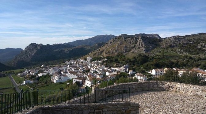
One of the most interesting ways to explore the area is to follow the remains of the Roman road between Villaluenga del Rosario and Ubrique, which passes close to Benaocaz. The village itself also has several historic buildings, including the Ermita de San Blas, the Ermita del Calvario and the Iglesia de San Pedro Apóstol.
The Eco-Museum provides an introduction to the natural and human history of the area, making Benaocaz a worthwhile stop on the western section of the white village routes.
Benamahoma: population 392 (2026), 500m above sea level
Benamahoma lies in the foothills of the Sierra del Pinar and forms part of the municipality of Grazalema. The village has a very different feel from Grazalema itself, with the surrounding mountains and the River Majaceite giving it a particularly green setting.
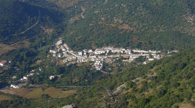
At the Fuente de Nacimiento, a natural spring rises from the mountains and forms the beginning of the River Majaceite, which flows towards El Bosque. Water has played an important role in the history of the area, powering mills used for producing flour and olive oil as well as for other traditional industries.
The Eco-Museum of Water (Ecomuseo del Agua) explores this relationship between the river, water power and the development of the local communities. Benamahoma is also a useful stop on the driving routes through the Sierra, particularly on the road between Grazalema and El Bosque.
El Bosque: population 2,244 (2026), 298 m above sea level
El Bosque sits at the western edge of the Sierra de Grazalema, beside the River Majaceite, and has a more open, lowland setting than the mountain villages further into the Sierra. Its origins are linked to the expansion of the area after the Christian conquest, when land was granted to the Marquis of Cádiz and a settlement developed to house his growing household and entourage.
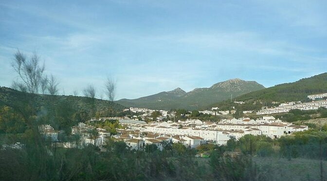
The river has played an important role in the history of El Bosque. Its waters powered mills and supported local industries, while the surrounding countryside provided fertile land and abundant water. Today, the Molino de Abajo preserves part of this industrial heritage as a water-powered flour mill and bakery museum.
The village is also home to a botanical garden, with a collection of plants from the Sierra growing in natural surroundings. Together with the river and the historic mill, it gives El Bosque a character quite different from the higher white villages around Grazalema.
Grazalema: population 1,977 (2026), 812m above sea level.
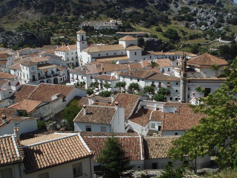
Grazalema occupies a spectacular position in a mountain cleft beneath Peñón Grande, surrounded by the limestone peaks of the Sierra de Grazalema. Its whitewashed houses climb the steep slopes, while the narrow streets and traditional architecture give the village much of the character for which the pueblos blancos of Andalucía are known.
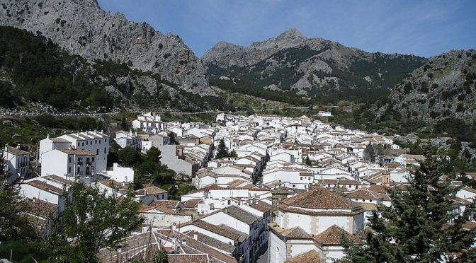
The settlement has deep Muslim-era origins, although much of the architecture visible today reflects later periods of development, particularly the economic expansion of the 18th and 19th centuries. Grazalema eventually gave its name to the surrounding Sierra de Grazalema Natural Park, which was established in 1984 and is known for its exceptional biodiversity and the rare Spanish fir (Abies pinsapo).
For visitors, Grazalema is more than a scenic viewpoint or starting point for exploring the mountains. The village itself is worth exploring on foot, with historic churches, traditional streets, viewpoints and places to eat, while its position makes it an excellent base for discovering the wider Sierra.
Prado del Rey: population 5,738 (2026), 440 m above sea level
Prado del Rey lies on the western edge of the Sierra de Grazalema, with a more open landscape than the mountain villages further into the range. The present town was established in the 18th century as part of a programme to repopulate the area, with land distributed first to local families and later to settlers from further north. Archaeological finds show that the area was inhabited much earlier, including evidence from the Neolithic and Bronze Age. Nearby Iptuci provides further evidence of the area’s Roman history, although the site is not currently open to visitors.
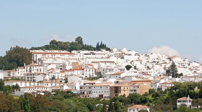
The town’s relatively recent origins are reflected in its planned layout, with streets arranged around a central square. Prado del Rey developed economically through wine production during the 19th century and later became associated with furniture making and leather goods. Today, its position on the western side of the Sierra makes it a useful stop when exploring the white villages and countryside between the mountains and the Cádiz plain.
Ronda: population 33,671 (2026), 723 m above sea level.
Ronda is the largest settlement included in these routes and has a very different character from the smaller white villages. The city occupies a dramatic position on the cliffs above the narrow El Tajo gorge and combines striking natural scenery with an important historical and cultural heritage.
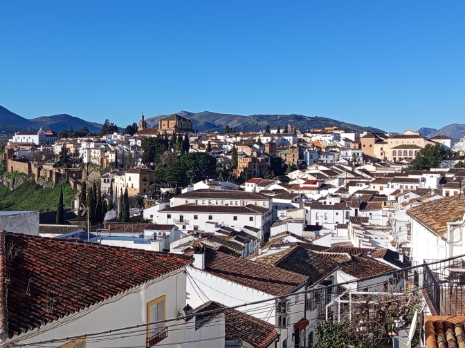
Its elevated position made Ronda a naturally defensible settlement on an important route through the mountains. The area passed through several periods of control before the arrival of the Muslims in 713, and Ronda was later taken by the Catholic Monarchs in 1485. The city also played a significant role during the Peninsular War in the early 19th century, when the Napoleonic invasion brought considerable hardship to the area.
Ronda is an excellent addition to a journey through the Sierra de Grazalema, particularly for visitors interested in history and architecture as well as mountain scenery. The Puente Nuevo, historic Arab baths, Islamic walls and gates, and Palacio de Mondragón are among the main sights to explore.
Full tourist information for Ronda at rondatoday.com
Setenil de las Bodegas: population 2,634 (2026), 640 m above sea level
Setenil de las Bodegas has one of the most unusual settings of all the white villages in this part of Andalucía. Rather than being built mainly across the surrounding hillsides, much of the village occupies the narrow gorge of the Río Guadalporcún. Houses and streets have been built beneath the enormous rock overhangs, with the natural cliffs forming part of the buildings themselves.
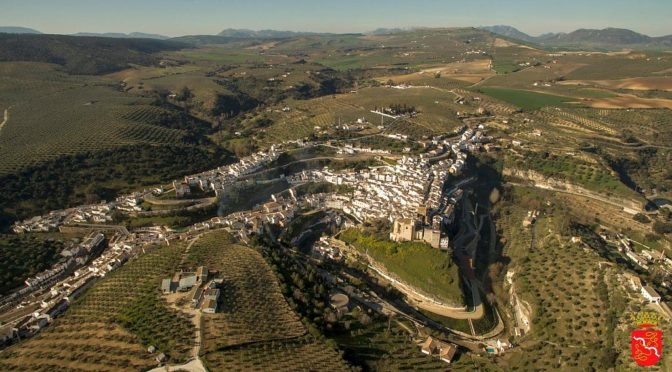
The village has a long history and its strategic position made it an important stronghold during the later stages of the Christian conquest. The castle was originally built by the Muslims and Setenil was eventually taken by the Catholic Monarchs in 1484. The name ‘Bodegas’ reflects the area’s historic association with wine production, although the region’s vineyards were badly affected by the phylloxera epidemic in the late 19th century.
The castle, Iglesia de Nuestra Señora de la Encarnación and Antigua Casa Consistorial are among the principal historic buildings to see, but much of Setenil’s appeal comes simply from walking through its unusual streets and seeing how the village has been built into the gorge.
Ubrique: population 16,624 (2026), 330 m above sea level
Ubrique has a long history, with evidence of settlement in the area dating back to the Palaeolithic period as well as evidence of Iberian or pre-Roman occupation. A Roman road that can still be seen today connected Ubrique with Acinipo, while the town itself was conquered by the forces of the Catholic Monarchs in 1485.
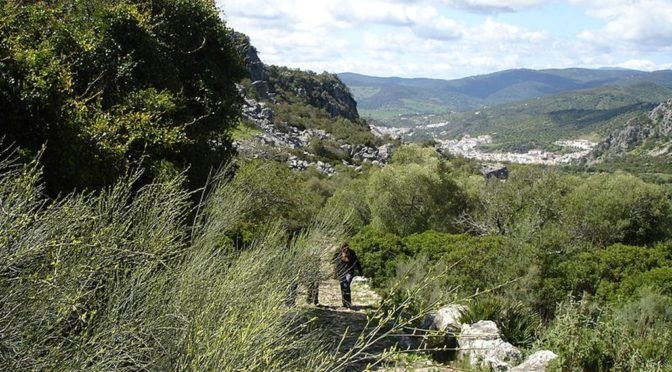
The early 19th century was another turbulent period in Ubrique’s history. The village was affected by the French occupation under Napoleon, and much of its historic architecture was destroyed during the fighting. Important archives dating back to the 15th century were also lost.
Ubrique is particularly famous for its leather industry. The first leather factories were established here in the 17th century, beginning a tradition that continues to define the town today. Its long association with leatherworking makes Ubrique one of the most distinctive stops on the western route through the white villages of the Sierra de Grazalema.
Villaluenga del Rosario: population 471 (2026), 858 m above sea level.
Villaluenga del Rosario is the highest of the white villages in Cádiz province, sitting at 858 metres above sea level in a rugged valley beneath the cliffs of the Sierra del Caíllo. The village was founded during the Muslim period and was taken by the Catholic Monarchs in 1485. Its dramatic mountain setting and traditional architecture make it one of the most distinctive stops on the western route through the Sierra.
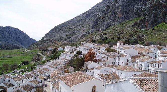
The village is also known for its unusual polygonal bullring, built in the 18th century from local stone and regarded as the oldest bullring in the province of Cádiz. Just below the village, the Sima de Villaluenga is a deep natural sinkhole and cave system popular with cavers. A signposted route leads towards the entrance, where the initial drop is around 60 metres. Water from the underground system eventually emerges at Ubrique.
Zahara de la Sierra: population 1,354 (2026), 500 m above sea level
Zahara de la Sierra is dramatically positioned on a rocky hill overlooking the surrounding countryside, with its castle occupying the highest point above the village. The castle was built by the Muslims in the 13th century and rebuilt in the 14th century, and its strategic position made Zahara an important stronghold during the conflicts between Muslim and Christian forces. The village was eventually taken by the Catholic Monarchs in 1483. Today, the climb to the castle tower is rewarded with spectacular views across the Sierra and the surrounding countryside.
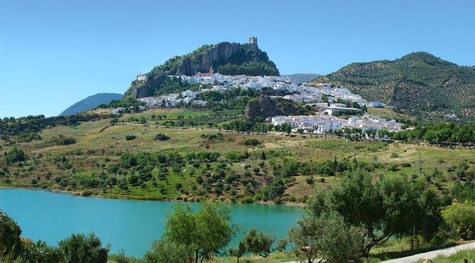
The rock beneath the castle also preserves evidence of the area’s long history. Remains found here include an Iberian cistern, a Roman cistern and the remains of successive Christian and Muslim places of worship, reflecting the changing control of the settlement over the centuries. Exploring the castle area and historic centre provides a good introduction to Zahara’s importance as a strategic mountain settlement.
Acinipo: (This is not one of the white villages)
Ronda La Vieja or Acinipo was originally an Iberian settlement which came under Roman rule at the end of the Second Punic War around 202 BC with the defeat of General Hannibal and Carthage. Acinipo, as it was known to the Romans, is thought to mean “Amongst the vineyards”. Whilst most of the architectural sights to be seen are from the Roman age, there are also important prehistoric habitation remains with the oldest dating from the Neolithic period of around 4000 years ago through the Copper and Bronze ages.

It is located on a high, easily defensible hill of 999 metres in the Serranía de Ronda. It contains the remarkable remains of the Roman theatre built in the 1st century that include the lower seating levels carved from the very bedrock and much of the original main wall is intact apart from some rather ugly concrete reparation work carried out during the 1980’s.
The tiered seating was sufficient for 2000 people and separate entrances kept the classes apart whilst the main wall would have been adorned with the statues of gods and emperors, the all powerful benefactors that controlled the lives of the citizens.
Acinipo was abandoned in the sixth century after many years of decline starting from the third century. A once powerful city that minted its own coinage and had its own magistrates was left to ruin with the centre of power switching to what is now the town of Ronda. The coins were stamped with a triple bunch of grapes on one side and the word “Acinipo” between ears of wheat on the other side and it is believed the coinage was produced from 56 to 53 BC.
Find out about opening times and more information at the Ronda Today website
Frequently asked questions about the white villages of the Sierra de Grazalema
There are numerous white villages and towns in and around the Sierra de Grazalema, spread across Cádiz and Málaga provinces. The villages covered in this guide include Grazalema, Zahara de la Sierra, Villaluenga del Rosario, Benaocaz, Benamahoma, El Bosque, Prado del Rey and Ubrique, with Ronda and Setenil de las Bodegas also included on one of the driving routes.
Grazalema is the village that gives the surrounding Sierra de Grazalema its name and is one of the best-known destinations in the area. It is particularly notable for its spectacular mountain setting, whitewashed houses and historic centre.
It is possible to visit some of the villages by bus, but public transport connections between the smaller mountain villages can be limited. A car gives you considerably more flexibility, particularly if you want to follow the scenic driving routes and stop at viewpoints, villages and other places of interest along the way.
There is no single route that covers all the villages. This guide describes three circular driving routes, each exploring a different part of the Sierra. The best choice depends on how much time you have and whether you are more interested in mountain scenery, historic sites, traditional villages or places such as Ronda and Setenil de las Bodegas.
Benamahoma is close to Grazalema on the road towards El Bosque, while Zahara de la Sierra lies to the east. Villaluenga del Rosario and Benaocaz are to the west, on the route towards Ubrique. The distances are relatively short, but the winding mountain roads mean that journey times can be longer than the distances on a map suggest.
The villages are known for their whitewashed houses, historic buildings and spectacular mountain settings, but each has its own character. Local traditions include cheese production in Villaluenga del Rosario, leatherworking in Ubrique, traditional crafts and agriculture, while the surrounding Sierra is known for its exceptional landscapes and wildlife.

I’ve been living in this lovely area of Western Andalucia for the last 20 years or so and dedicate most of my time to the running of English language tourist information websites for the towns of Cádiz, Ronda, Grazalema, the famous or infamous Caminito del Rey, and also Wildside Holidays, which promotes sustainable and eco-friendly businesses running wildlife and walking holidays in Spain. My articles contain affiliate links that will help you reserve a hotel, bus, train or activity in the area. You don’t pay more, but by using them you do support this website. Thankyou!
11 thoughts on “The white villages of the Sierra de Grazalema”